
Projects
-
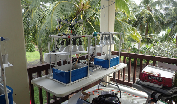
Mapping Coral Thermal Toughness Across American Samoa
This project provides data for a growing atlas of coral thermal "toughness" across reef sites in American Samoa, a better understanding of the effects of management actions on coral thermal resistance, a first-generation regional model of the evolution of these critical thermal thresholds, and informs and engages local communities of these issues.
-
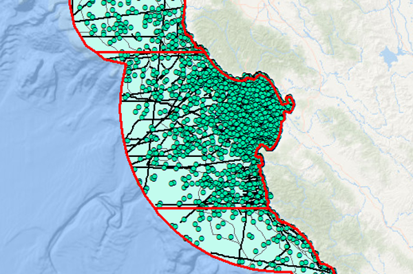
Spatio-Temporal Distribution of Published Research Studies in the Monterey Bay National Marine Sanctuary
The project focused on quantifying the distribution of published research studies across the MBNMS based on focal ecosystems and taxonomic categories. More than 13,000 articles were considered.
-
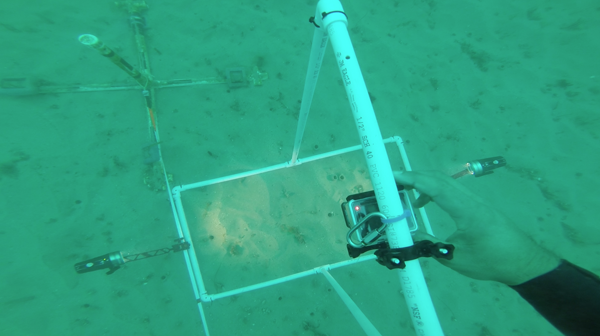
Subtidal Site Characterization for a Proposed Desalination Facility on Cannery Row
Many coastal communities in arid or drought-prone regions around the world are considering, adopting, or already using desalination plants to supplement limited fresh water supplies. This project positions the Monterey Bay National Marine Sanctuary to detect and measure any impacts that may occur due to installation and/or operation of the proposed Ocean View Plaza desal facility and thereby contribute to our understanding of potential desal impacts and how best to minimize them.
-
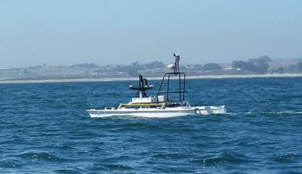
San Francisco Bay Shallow Water Mapping
Ultra-shallow water habitats were mapped at high priority locations in San Francisco Bay. A post-project USV demonstration indicated that it will be a valuable tool for mapping other bays and estuaries along the California coast. These data are a crucial piece of the modeling effort being undertaken by the State as it plans for sea level rise is urban coastal communities.